
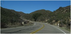
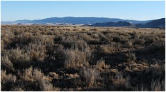
I think you can get an idea of how dry it is in this part of California by the pics. Ther are not that many trees and those that exist are either reallly tough local oaks or growing in drainage lines.
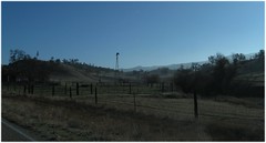
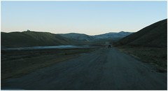
Then we hit California Valley. Oh my. What a benighted place! This technically isn't California Valley itself, but it is darned close and is a better pic than the others we got.
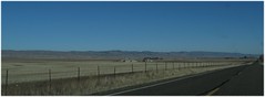
Imagine land developers thinking, hey who wouldn't want to live here? Soil is alkaline, there's a soda lake down the road, the water supply is from an aquifer that is a bit iffy, there's no trees, it bakes in summer and freezes in winter (overnight), but there's plenty of sun! Let's set up for a town of 50,000 people or so. The road map of California shows a heap of roads to be set up in a grid.
Ahem.
Well some people set up house and still live in the area but really you'd have to enjoy being isolated.
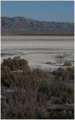
There isn't that much to do in California valley. We drove along Soda Lake Road, to see the soda lake.
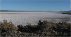

It has a top notch recycled plastic boardwalk, for those times when it is wet I guess.
Not much can grow in the alkaline clay soil.
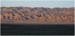
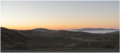
See those wrinkly hills on the other side of the valley? Well those would be the Carrizo Plain part of the San Andreas Fault. Yep, The Big One!
How'd you like to live right next to one of the most notorious faults in the world?
We'd stumbled on one of the best places to see the San Andreas, and it was getting too late to go exploring. We had driven down Soda Lake Road (mostly paved but with a 10 or mile stretch of unpaved road) just randomly and there we were, driving through a national monument and beside the San Andreas.
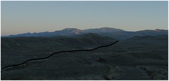
This is a bit of a punt but I think the fault runs through this valley. There was a really odd dip, like a creek bed that had moved, near the end of the road that made us very suspicious.
This is a really dull pic but from Google maps and digging around online, I am pretty sure that the San Andreas fault runs right next to the road here, through that puddle.
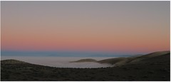
Sunset was pretty - you get too many pics of it :-)
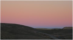
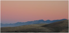
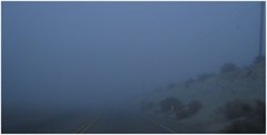
I think you can see something lurking in a couple of those pics. Lurking just down the hill and waiting to swallow us whole.
I hadn't realised how high up we were until we hit the fog bank and kept driving down down down. Gods it must be dull in Central Valley if it is foggy for half of winter. The fog was pretty dense at first but soon I had plenty of visibility to do the speed limit. We stayed in Bakersfield at a cheap but perfectly adequate motel that even had a microwave and bar fridge! Yay for microwaved dinners :-)
No comments:
Post a Comment